Source: The politics of land use change over 25 years in Zimbabwe | zimbabweland The gaze from space is very seductive. Satellite image analysis seems to dominate land use systems science these days and certainly the technologies available have far outstripped the careful analysis of air photos with optical steroscopes and chinagraph pencils. But the […]
The gaze from space is very seductive. Satellite image analysis seems to dominate land use systems science these days and certainly the technologies available have far outstripped the careful analysis of air photos with optical steroscopes and chinagraph pencils. But the satellite gaze can be misleading. Trends can be asserted when in fact variation is central. Patches where important dynamics occur can be missed. This is why careful interpretation, as any GIS analyst will tell you, is key.
When we first analysed our satellite images (see the first blog in this series), a set of graphs of changes in different land use types across the time periods were produced. These covered a whole site and were impossible to interpret. There seemed to be no pattern. We had to go to the field and ask people who lived in these landscapes over the past 25 years to get any meaningful interpretations. And in our workshops across the sites, the discussions were incredibly revealing. A number of themes emerged, which we discuss in the following sections.
Non-linear environmental change
As the aggregate graphs suggested, there were no simple, linear trends across our sites. A non-linear dynamic was observed. This was driven in part by variable rainfall, resulting in increasing vegetation cover in certain periods and declines in others, along with the appearances of wetland patches in periods of high rainfall. But our participatory discussions showed that these were not just biophysical changes, but were driven by human use and politics.
There were periods of extensification as land was cleared and crop fields expanded, but also periods when fields contracted, and home gardens were the focus. Wetland areas, which are so important for key resource grazing and small-patch irrigated agriculture, especially in the drier, sandy soil sites, also expanded and contracted over time. These changes were in part in response to rainfall availability, but also changing labour patterns, ageing of households, availability of cattle for draft power and manure, and so on. Certain areas also saw sudden deforestation, running against the wider trends, and these were often explained by the settlement of people by politicians eager for votes or through invasions by former farmworkers and others. Soils changed too, with sandy soils losing fertility rapidly through cultivation, but certain areas accumulating nutrients and organic matter as erosion processes redistributed soils in the landscape, creating new configurations of patches.
A whole series of ecological, economic, social and political drivers therefore intersected, often resulting particular moments of significant change, but always unpredictable and contingent on conjunctural circumstances. And change often occurred in particular patches – for example key resources such as wetlands or hills. For these landscapes are far from uniform, even in small areas. Environmental heterogeneity means that aggregate pictures across space as with time are problematic.
These non-linear spatial and temporal patterns mean that standard narratives about environmental change and management don’t hold up. There is often easy recourse to the usual arguments about carrying capacity, soil fertility decline, desertification and land degradation that emerge from technically-driven land use assessments. But these are quickly undermined when the non-linear nature of environmental change is revealed.
Beyond the population pressure argument
The commentary by local people in our workshops analysing the satellite images often focused on the challenges of ‘population increase’. At face value it sounded like a familiar Malthusian argument for increasing population pressure resulting in scarcities and so resource intensification and degradation. When stories were told over the full 25 years, they sounded like a linear process of change from a simple baseline, when all was fine. But when probed a bit further, this was not just a demographic story of population pressures increasing environmental degradation contrasting with a relatively pristine state when white farmers used the land, but one of changing politics, land control and social relations.
For sure, populations in all our sites have increased over time. This is what happens with redistributive land reform: from one white owner and some workers to many families taking the land. That this results in land use change is hardly surprising. More interesting are the changes that have happened since the land was taken, and how changes in land control have emeged.
Some of the land use changes seen were the direct result of subdivisions of land for the next generation. But there was also in-migration, often at certain times, usually around elections when favours were bought through allocating land by local politicians. And the changes that were seen were also driven by commerce, and the growing importance of tobacco in Mvurwi in particular. Capitalist relations in a commercialised agricultural economy, changing the value of land, the relations of labour and the demand for wood fuel for curing Virginia tobacco all combined. This was not just ‘population pressure’, but the operation of capitalist relations in the environment affecting land use change.
The declining commons
One feature highlighted in all our sites was the decline in common land and the subsequent undermining of common property resource management institutions. As land use intensifies, land values increase and more people arrive, the incentives to enclose and exclude increase. The result has been a change in how people hold land with new forms of property relation. The expansion of land into what were common areas for grazing, wood fuel and non-timber forest product collection has been seen in all our sites. Sometimes people would enclose a small hill near their home, once used collectively. In other cases, people would expand fields into grazing areas. And most dramatically, local leaders would settle whole groups in common areas illegally, and usually for some form of payment.
The decline in cattle populations due to disease impacts (notably January Disease) has coincided with this trend, but those still with any cattle have to find new ways to graze their animals, sometimes enclosing new land themselves or resorting to stall or tethered feeding. The decline in common land hits people unevenly, as participants in our workshops explained, with livestock owners suffering but also those who used to collect firewood, indigenous fruits and plants, as younger people and women explained.
The failure to exclude outsiders, the lack of sense of a bounded community and the absence of collective rules to manage resources these days is, people explained, the direct result of a lack of stable authority in these areas – whether chiefs, headmen and traditional leaders or VIDCOs and party people. The ‘design principles’ of common property resource management that Elinor Ostrom highlighted many years ago no longer apply, and this is largely down to failures in politics and confusions over authority. In all discussions across sites, the incumbent leaders were castigated, and it didn’t matter whether these were ‘traditional’ or ‘modern’ party leaders, as none were able to uphold the long-standing systems that once governed the use of common property areas.
Sacred spaces
Within all our sites, local people were able to identify sacred sites where spirit guardians traditionally protected the environment. These were particular wetlands that never dried up with pools and ponds where njuzu (mermaids) lived. These were hills where rain-making ceremonies took place and where particular codes of conduct were required, lest the spirits became angry. And these were particular sacred trees, protected by snakes and other spirits, often associated with ancient grave sites. Sacredness in the new resettlements however had to be remembered or reinvented after land reform as these areas had previously been inhabited by whites, with labourers often originally from other countries.
The war veteran leaders who occupied the land, however, had to respect the original spirits of the land and supplications were carried out during the invasions. Once the land was taken over, the Seven Member Committees often offered guidance on what areas needed protecting, while spirit mediums and local traditional leaders were enlisted. But because these areas did not come under the formal jurisdiction of chiefs and their headmen, there was often a tussle between chiefs over who had control, with a to and fro between different chiefs, often influenced by wider politics. This has been an issue in a number of our sites, causing confusion over who is in charge. The result is that that chief’s guidance can be inconsistent and confusing, with the chief’s ‘police’ in charge of enforcing environmental rules often undermined by the lack of chiefly authority.
The village and party committees that stepped into this power vacuum often failed to uphold environmental rules. Although emerging from the powerful Seven Member Committees who were established following the land invasions, they did not have the same associations with ‘tradition’ and respect for spiritual land governance. Sacred sites therefore are few and far between these days and many go unprotected, despite local knowledge of their importance. As participants in our workshops commented, people these days do not respect these traditions, with ‘modern ways’ of the younger generations and the rise of Christianity undermining traditional systems of environmental management.
Resource politics
Environmental change is inevitably political, both influenced by politics and influencing politics. Across our sites, we see major changes in land use precipitated by political interventions, with party officials often lobbying during election periods through the preferential allocation of land. The mobilisation of ‘youth’ without land to do politicians’ bidding, especially during the contested elections, was often paid for with the allocation of plots. And local leaders, notably sabhuku headmen, have been very busy in the land reform areas allocating land in former grazing areas, hills and mountains as demand for land has increased, and usually for payment. The enclosure and privatisation of land is driven by this politics, pushed on by commercial pressures as land becomes more valuable.
But, as already hinted, it is the lack of firm authority that has undermined the capacity of local communities to manage their land, much to their frustration. Changes between traditional authorities and village committees, the shifts between chiefs controlling areas and the interference of party politics into local affairs have all upset attempts to gain control. Many look back to the period of the land occupations – ironically often seen as a time of chaos and violence, of ‘jambanja’ – as one where clear authority was exerted to the benefit of environmental management. Local governance remains in flux, and the lack of clarity from the state on how devolved authorities should be managed, combined with much political interference from party organs, disrupts local contexts to the detriment of the environment.
The hidden politics of satellite image maps
In sum, underneath the colour-coded maps lies a complex struggle over authority, with implications for land use and management. The neat statistics emerging from land use and land cover assessments belie a much more complex social and political story, one that is fundamentally about land, power and politics. Without attention to these dimensions, the technocratic recommendations about ‘combatting desertification’, ‘reducing deforestation’ or ‘managing wetlands’ for example emerging from such satellite-based land use assessments will be of no use. This makes the type of engaged, participatory analysis that we have been conducting across our sites essential. Only through such explorations, as this blog series has shown, can the real politics of land use change be revealed.
This is the final blog in a series on land use and environmental change and was written by Ian Scoones, with Tapiwa Chatikobo, Keen Marozva and Felix Murimbarimba. Photo credit: Alport Ndebele. The blog first appeared on Zimbabweland
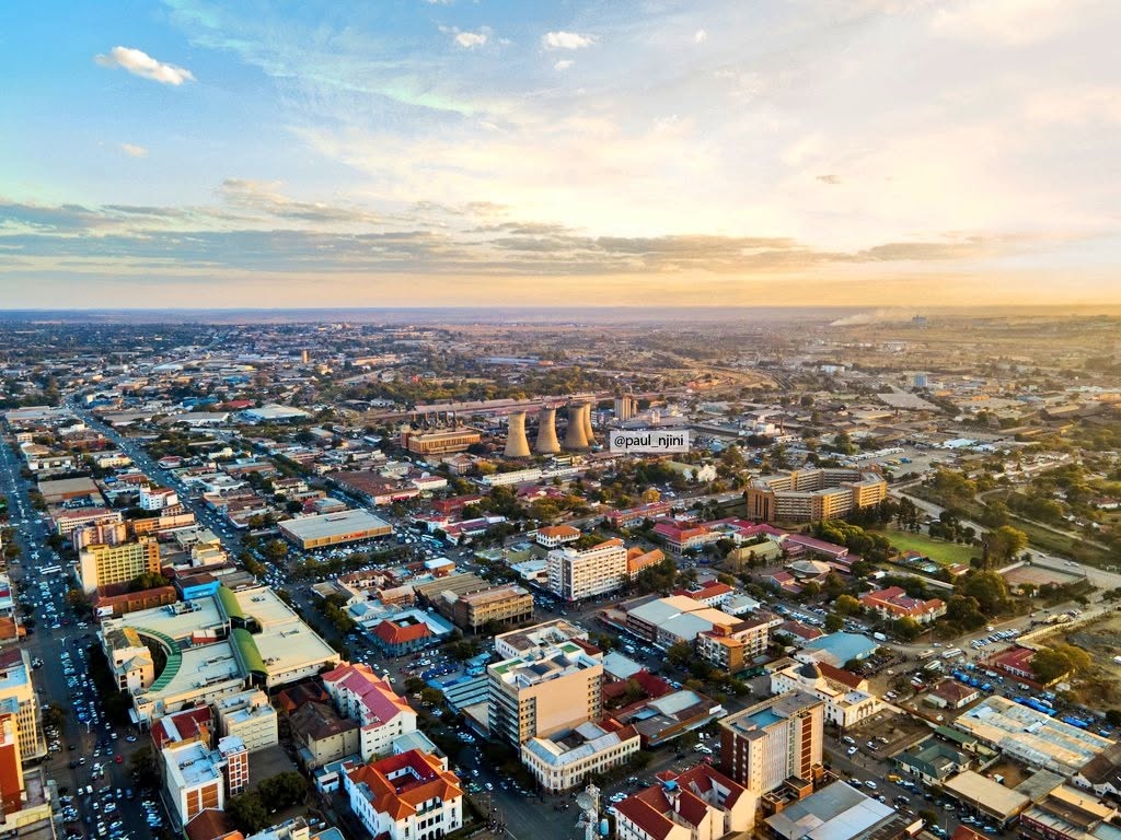
Source: BCC encourages walking and vehicle sharing to ease traffic congestion — CITEZW Bulawayo residents have been encouraged to walk and share vehicles to ease traffic congestion and reduce carbon emissions in the city, with the local authority arguing that the central business district is compact enough to navigate on foot. Speaking to CITE, Bulawayo […]
Bulawayo residents have been encouraged to walk and share vehicles to ease traffic congestion and reduce carbon emissions in the city, with the local authority arguing that the central business district is compact enough to navigate on foot.
Speaking to CITE, Bulawayo City Council Corporate Communications Manager Nesisa Mpofu said the city was urging residents to leave their vehicles at home where possible and adopt a walking culture, particularly in the CBD.
“Our thrust as a city is that at some point, we need to encourage residents and ourselves to adopt the culture of walking in the central business district. The CBD of Bulawayo is not very vast in terms of kilometres, so sometimes we encourage you to park your car or leave it at home and walk, because at the moment there are a lot of vehicles coming in,” Mpofu said.
She added that vehicle sharing within households and communities could further cut both congestion and the city’s carbon footprint.
“Sometimes you find that in one household three vehicles are leaving at the same time, all going in the same direction. If vehicles are shared — whether within families or communities, it will also help us reduce our carbon emissions as a city,” she said.
Mpofu outlined several measures already in place or under consideration to decongest the CBD. She said the parking management scheme being implemented by Tendy Three Investments (TTI) was already helping to regulate vehicle flow in the city centre. The city is also exploring proposals to convert Herbert Chitepo Street and Fort Street into one-way traffic lanes, though she said implementation would depend on road conditions and the availability of rehabilitation funding.
“For us to start on the roads, we have to look at the quality and state of the road, and how much is needed to rehabilitate them to ensure that when they are converted, they are in a good condition,” she said.
Mpofu said the installation of barricades along Robert Mugabe Way had already yielded results, improving traffic flow and curbing dangerous driving habits such as illegal U-turns and stopping in the middle of the road.
“At one point it was becoming difficult to navigate that intersection, but since we barricaded and created a one-way flow of traffic, it has eased the congestion,” she said. “You find that it also helps to manage driver behaviour, because people were doing U-turns and stopping in the middle of the road to pick up or drop off passengers. With the barricades, that is no longer possible.”
She acknowledged that the changes initially met with resistance from some road users but said the public had since adapted.
“We initially had a lot of resistance, where people felt it was making their journeys longer, but with time I think we have really mastered the system as residents,” Mpofu said.
She also appealed to residents not to use the drums placed along roads as rubbish bins, noting they were temporary structures that would eventually be replaced by concrete barricades.
On a crisp evening in mid-June 2026, the global entertainment landscape witnessed an unprecedented cultural shift. Millions of viewers across the globe sat glued to their screens as a 22-episode supernovela titled The Polygamist broke its way into Netf…
On a crisp evening in mid-June 2026, the global entertainment landscape witnessed an unprecedented cultural shift. Millions of viewers across the globe sat glued to their screens as a 22-episode supernovela titled The Polygamist broke its way into Netflix’s global non-English Top 10 chart, racking up an astonishing 19.1 million viewing hours in its debut […]
BEIJING — Zimbabwe is intensifying its drive to secure strategic infrastructure partnerships for its flagship New City development in Mt Hampden, with fresh discussions held in Beijing between the country’s delegation and the China State Construction Engineering Corporation (CSCEC) China State Construction Engineering Corporation. The engagement, led by the Minister of Finance, Economic Development and […]
BEIJING — Zimbabwe is intensifying its drive to secure strategic infrastructure partnerships for its flagship New City development in Mt Hampden, with fresh discussions held in Beijing between the country’s delegation and the China State Construction Engineering Corporation (CSCEC) China State Construction Engineering Corporation.
The engagement, led by the Minister of Finance, Economic Development and Investment Promotion, Hon. Prof. Mthuli Ncube Mthuli Ncube, focused on deepening potential technical and financial collaboration for the planned urban development on the outskirts of Harare.
The Mt Hampden New City, which is already at an early implementation stage with enabling works underway, is being positioned as a transformative urban hub incorporating advanced infrastructure, industrial zones, and digital economy enablers, including data centres intended to support artificial intelligence and wider digital services.
During the high-level talks, CSCEC leadership outlined its global track record in delivering large-scale “new city” developments, presenting an integrated model that spans conceptual planning, financing, construction, and full infrastructure rollout. The corporation referenced landmark projects such as the Xiong’an New Area Xiong’an New Area, Egypt’s New Administrative Capital New Administrative Capital, and major urban developments in Indonesia, as examples of its end-to-end delivery capability.
The Zimbabwe delegation was also given a guided tour of CSCEC’s exhibition centre, where they reviewed completed and ongoing projects across China and other international markets. The displays showcased the firm’s engineering capacity, smart city technologies, and integrated infrastructure systems designed for large-scale urban transformation.
CSCEC officials expressed willingness to support Zimbabwe’s New City agenda, signalling readiness to provide technical expertise, advanced construction technologies, and potential financing models to support project execution. However, they underscored that overall strategic planning and policy direction would remain the responsibility of the Government of Zimbabwe, with CSCEC acting as a technical and implementation partner.
The discussions align closely with Zimbabwe’s National Development Strategy 2 (NDS2), particularly its infrastructure development and modernisation pillar, which prioritises the creation of industrial growth nodes, modern urban settlements, and investment-driven economic transformation.
Prof. Ncube emphasised Zimbabwe’s macroeconomic stability framework during the engagement, positioning it as a key enabler for attracting long-term capital and sustaining large-scale infrastructure initiatives such as the Mt Hampden development.
Zimbabwe’s grain and oilseed markets remain under pressure from tightening supplies, with strong demand for maize and soya beans continuing to outstrip available stocks and support elevated prices, according to the latest market update from the Zimbabwe Mercantile Exchange (ZMX). The exchange said persistent supply shortages, particularly in the maize and oilseed sectors, are sustaining […]
Zimbabwe’s grain and oilseed markets remain under pressure from tightening supplies, with strong demand for maize and soya beans continuing to outstrip available stocks and support elevated prices, according to the latest market update from the Zimbabwe Mercantile Exchange (ZMX).
The exchange said persistent supply shortages, particularly in the maize and oilseed sectors, are sustaining firm prices despite increased harvesting activity and improved deliveries into formal markets.
Millers, stockfeed manufacturers and processors continue to compete for limited stocks, while the wheat market is showing signs of oversupply that could place downward pressure on prices.
According to ZMX, maize prices edged up marginally by 0.03 percent during the latest trading period to US$348.60 per metric tonne (MT), reflecting a market that remains relatively stable but constrained by limited supply.
The exchange noted that maize prices are trading slightly above the current import parity estimate of US$337 per tonne, suggesting that domestic demand remains strong enough to sustain local prices.
“Soya bean prices stood at US$551/MT, broadly in line with import parity levels of US$550/MT, while wheat traded at US$470/MT, below the import parity benchmark of US$488/MT, making local wheat more competitive against imported supplies,” ZMX said.
The exchange highlighted significant imbalances between supply and demand across several key commodities.
Demand for white maize currently stands at 6,500 tonnes compared to available supply of only 2,000 tonnes.
The situation is even more pronounced in the yellow maize market, where demand of 3,120 tonnes far exceeds available stocks of just 360 tonnes.
As a result, maize prices have remained firm, with sellers offering white maize at between US$345 and US$350 per tonne, while buyers are willing to pay as much as US$350 per tonne.
“The narrow price spread suggests strong market liquidity and indicates that maize prices are likely to remain supported in the near term as buyers compete for limited available stocks,” the exchange said.
The oilseed market is experiencing a similar trend.
Demand for soya beans has reached 4,000 tonnes against available supply of only 500 tonnes, highlighting a substantial shortage.
Sellers are currently offering soya beans at between US$555 and US$560 per tonne, while buyers are bidding between US$540 and US$550 per tonne.
In contrast, wheat is facing a surplus supply situation.
Available wheat stocks total 2,000 tonnes, double the current demand of 1,000 tonnes.
The exchange said this imbalance, coupled with a significant gap between seller expectations and buyer offers, may place downward pressure on wheat prices unless demand improves.
Sellers are seeking approximately US$525 per tonne for wheat, while buyers are offering between US$440 and US$470 per tonne.
Overall, ZMX said the market continues to be driven by robust demand from food processors, millers and stockfeed producers seeking raw materials for production.
Regionally, Zimbabwe’s maize prices remain among the highest on the continent despite recent moderation.
Prices on the local exchange have eased from approximately US$355 per tonne to US$348 per tonne over the past month as harvesting activity increased and more grain entered formal trading channels.
However, Zimbabwean maize continues to trade at a significant premium compared to several neighbouring markets.
South Africa remains the lowest-priced maize market in the region at approximately US$194 per tonne, while markets in Zambia, Malawi, Tanzania, Mozambique and Nigeria are trading within a range of US$217 to US$328 per tonne.
The latest market data suggests that unless grain deliveries improve significantly, strong demand and limited supplies are likely to keep maize and soya bean prices elevated in the short term, while wheat prices may face increasing pressure from excess stocks.